Serving Mapbox Vector Tiles with PostGIS, Nginx and Python Backend
Since version 2.4.0, PostGIS can serve MVT data directly. MVT returning queries put heavy workload on the database though. On top of that, each of the query has to be run again every time a client demands the data. This leaves us with plenty of room to optimize the process.
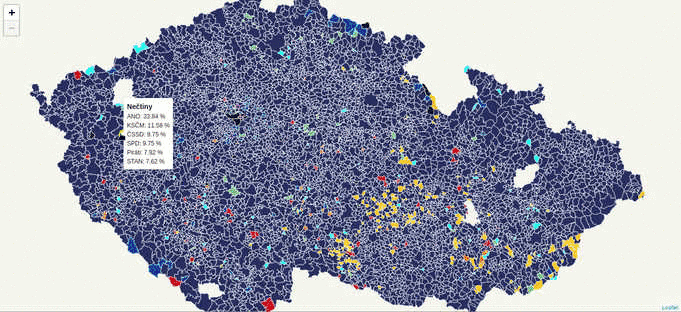
During the last week, while working on the Czech legislative election data visualization, I’ve struggled with the server becoming unresponsive far too often due to the issues mentioned above.

According to the schema, the first client to come to the server:
- goes through filesystem unstopped, because there are no cached files yet,
- continues to the Flask backend and asks for a file at
{z}/{x}/{y}, - Flask backend asks the database to return the MVT for the given tile,
- Flask backend writes the response to the filesystem and sends it to the client.
Other clients get tiles directly from the filesystem, leaving the database at ease.
Nginx
Nginx is fairly simple to set up, once you know what you’re doing. The /volby-2017/municipality/ location serves static MVT from the given alias directory. If not found, the request is passed to @postgis location, that asks the Flask backend for the response.
server election {
    location /volby-2017/municipality {
            alias /opt/volby-cz-2017/server/cache/;
            try_files $uri @postgis;
    }

    location @postgis {
            include uwsgi_params;
            uwsgi_pass 127.0.0.1:5000;
    }
}
Flask backend
Generating static MVT in advance
If you’re going to serve static tiles that don’t change often, it might be a good idea to use PostGIS to create files in advance and serve them with Nginx.
CREATE TABLE tiles (
    x integer,
    y integer,
    z integer,
    west numeric,
    south numeric,
    east numeric,
    north numeric,
    geom geometry(POLYGON, 3857)
);
Using mercantile, you can create the tiles table holding the bounding boxes of the tiles you need. PostGIS them inserts the actual MVT into the mvt table.
CREATE TEMPORARY TABLE tmp_tiles AS
    SELECT
        muni.muni_id,
        prc.data,
        ST_AsMVTGeom(
            muni.geom,
            TileBBox(z, x , y, 3857),
            4096,
            0,
            false
        ) geom,
        x,
        y,
        z
    FROM muni
    JOIN (
        SELECT
            x,
            y,
            z,
            geom
        FROM tiles
    ) bbox ON (ST_Intersects(muni.geom, bbox.geom))
    JOIN party_results_cur prc ON (muni.muni_id = prc.muni_id);
CREATE TABLE mvt (mvt bytea, x integer, y integer, z integer);
DO
$$
DECLARE r record;
BEGIN
FOR r in SELECT DISTINCT x, y, z FROM tmp_tiles LOOP
    INSERT INTO mvt
    SELECT ST_AsMVT(q, 'municipality', 4096, 'geom'), r.x, r.y, r.z
    FROM (
        SELECT
            muni_id,
            data,
            geom
        FROM tmp_tiles
        WHERE (x, y, z) = (r)
    ) q;
    RAISE INFO '%', r;
END LOOP;
END;
$$;
Once filled, the table rows can be written to the filesystem with the simple piece of Python code.
#!/usr/bin/env python

import logging
import os
import time
from sqlalchemy import create_engine, text

CACHE_PATH="cache/"

e = create_engine('postgresql:///')
conn = e.connect()
sql=text("SELECT mvt, x, y, z FROM mvt")
query = conn.execute(sql)
data = query.cursor.fetchall()

for d in data:
    cachefile = "{}/{}/{}/{}".format(CACHE_PATH, d[3], d[1], d[2])
    print(cachefile)

    if not os.path.exists("{}/{}/{}".format(CACHE_PATH, d[3], d[1])):
        os.makedirs("{}/{}/{}".format(CACHE_PATH, d[3], d[1]))

    with open(cachefile, "wb") as f:
        f.write(bytes(d[0]))
Conclusion
PostGIS is a brilliant tool for generating Mapbox vector tiles. Combined with Python powered static file generator and Nginx, it seems to become the only tool needed to get you going.